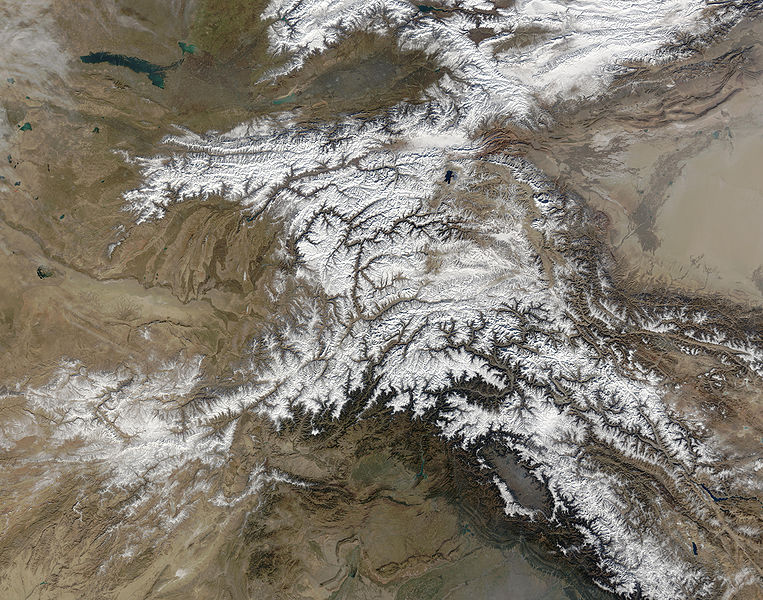
Ӳкерчĕк:Hindu Kush satellite image.jpg

Ҫак умкурӑмӑн виҫи: 763 × 600 пиксел. Ытти разрешенисем: 306 × 240 пиксел | 611 × 480 пиксел | 978 × 768 пиксел | 1280 × 1006 пиксел | 2560 × 2011 пиксел | 5600 × 4400 пиксел.
Оригиналлӑ файл ((5600 × 4400 пиксел, файл пысăкăше: 5,01 Мб, MIME-тĕсĕ: image/jpeg))
Файл историйĕ
Вӑхӑт ҫине пуссан, ун чухнехи версине пӑхма пулать.
| Дата/Вăхăт | Миниатюра | Калӑпӑш | Хутшăнакан | Асăрхав | |
|---|---|---|---|---|---|
| хальхи | 04:39, 6 Ҫӗртме уйӑхӗн 2006 |  | 5600 × 4400 (5,01 Мб) | Avenue | {{Information |Description=The Hindu Kush occupies the lower-left-center of this true-color MODIS satellite image, acquired 28 November 2003. |Source=[NASA's Earth Observatory http://earthobservatory.nasa.gov/Newsroom/NewImages/images.php3?img_id=16411] | |
Файлпа усă курни
Ку файлпа усӑ куракан страницӑсем ҫук.
Файлпа глобаллӑ усӑ курасси
Ку файлпа ҫак викисенче усӑ курнӑ:
- bcl.wikipedia.org усӑ курасси
- bn.wikipedia.org усӑ курасси
- ca.wikipedia.org усӑ курасси
- el.wikipedia.org усӑ курасси
- en.wikipedia.org усӑ курасси
- es.wikipedia.org усӑ курасси
- et.wikipedia.org усӑ курасси
- eu.wikipedia.org усӑ курасси
- fa.wikipedia.org усӑ курасси
- fi.wikipedia.org усӑ курасси
- it.wikipedia.org усӑ курасси
- mk.wikipedia.org усӑ курасси
- ml.wikipedia.org усӑ курасси
- mr.wikipedia.org усӑ курасси
- nl.wikipedia.org усӑ курасси
- nn.wikipedia.org усӑ курасси
- pa.wikipedia.org усӑ курасси
- pl.wikipedia.org усӑ курасси
- pnb.wikipedia.org усӑ курасси
- pt.wikipedia.org усӑ курасси
- ro.wikipedia.org усӑ курасси
- sk.wikipedia.org усӑ курасси
- sl.wikipedia.org усӑ курасси
- sr.wikipedia.org усӑ курасси
- ta.wikipedia.org усӑ курасси
- tg.wikipedia.org усӑ курасси
- th.wikipedia.org усӑ курасси
- uz.wikipedia.org усӑ курасси
- vi.wikipedia.org усӑ курасси


