Ӳкерчĕк:Maurya Empire, c.250 BCE 2.png

Страницӑри контент ытти чӗлхесенче ҫук.
«Википеди» ирĕклĕ энциклопединчи материал

Оригиналлӑ файл((1200 × 1121 пиксел, файл пысăкăше: 2,26 Мб, MIME-тĕсĕ: image/png))

Ку файлпа, на Викискладе илнӗскерпе, ытти проектсенче усӑ курма пултараҫҫӗ. Унӑн страницӑри ӑнлантарӑвӗпе аяларах паллаштарнӑ.

Кĕскен ăнлантарни

Ӑнлантарни
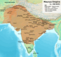
English: Note: This was the standard "textbook" map of the Maurya Empire. Historians are now arguing that the Maurya Empire did not include large parts of India, which were controlled by autonomous tribes. For such a map, see File:Maurya Empire, c.250 BCE.png.
Alternative map of Maurya Empire

Boundaries are based on Charles Joppen Historical Atlas of India (1907), see File:India_in_250_B._C.jpg.

Other Sources:

Other sources:

  • Grainger, John D. (1990, 2014). Seleukos Nikator: Constructing a Hellenistic Kingdom. Routledge.
  • Keay, John (2000). India, a History. New York: Harper Collins Publishers.
  • Kulke, H.; Rothermund, D. (2004). A History of India, 4th, Routledge.
  • Puri, Baji Nath (1996). Buddhism in Central Asia. Delhi: Motilal Banarsidass.
  • Raychaudhuri, H. C.; Mukherjee, B. N. (1996). Political History of Ancient India: From the Accession of Parikshit to the Extinction of the Gupta Dynasty. Oxford University Press.
  • Stein, Burton (1998). A History of India (1st ed.), Oxford: Wiley-Blackwell.

Notes:

  • Sri Lanka and the southernmost parts of India (modern Tamil Nadu and Kerala) remained independent, despite the diplomacy and cultural influence of their larger neighbor to the north (Schwartzberg 1992, p. 18; Kulke & Rothermund 2004, p. 68).
  • The account of Strabo indicates that the western-most territory of the empire extended from the southeastern Hindu Kush, through the region of Kandahar, to coastal Baluchistan south of that (Raychaudhuri & Mukherjee 1996, p. 594).
  • The claim that Aria/Herat was one of the provinces (alongside Arachosia, Gedrosia, and Paropamisadae) ceded by Seleucus to Chandragupta Maurya is often repeated, but Aria (modern Herat) "has been wrongly included in the list of ceded satrapies by some scholars [...] on the basis of wrong assessments of the passage of Strabo [...] and a statement by Pliny." (Raychaudhuri & Mukherjee 1996, p. 594). Seleucus "must [...] have held Aria", and furthermore, his "son Antiochos was active there fifteen years later." (Grainger 2014, p. 109).
  • "The region of Aria is definitely known to have been Seleucid under Seleucus I and Antiochus I as it definitely was after Antiochus III's great campaign in the east against the Parthians and Bactrians. [...] There is no evidence whatever that it did not remain Seleucid, like Drangiana, with which it is linked by easy routes." -Susan M. Sherwin-White and Amélie Kuhrt (1993) From Samarkhand to Sardis: A New Approach to the Seleucid Empire, University of California Press, pp.79-80.
  • It is recorded that Drangiana province continued to be in the Seleucids' hands, as per [1].
  • "Desert of Gedrosia [...] was left an unclaimed wilderness." —Kosmin, Paul J. (2014), The Land of the Elephant Kings Space, Territory, and Ideology in the Seleucid Empire, Harvard University Press, p.16
  • Schwartzberg (p. 18) speculates about the Buddhist culture and Kharosthi inscriptions/manuscripts found in Khotan, but these texts from Khotan, Turfan, and Tajikstan have all been shown to be later than the 1st century BCE (Puri, p. 185).
Дата
Ҫӑлкуҫ Хӑвӑрӑн ӗҫ
Автор Avantiputra7

Лицензилени

Я, владелец авторских прав на это произведение, добровольно публикую его на условиях следующей лицензии:
w:cv:Creative Commons
атрибуци ҫав условисемпех сарма юрать
Ку файл Creative Commons Attribution-Share Alike 3.0 Unported лицензипе мкилӗшӳллӗн сарӑлать.
Эсир ирӗклӗн:
  • ку ӗҫе ыттисене тивӗҫтерме – ку ӗҫе копилеме, сарма тата ыттисене пама
  • унашкаллисене хатӗрлеме – ку ӗҫе улӑштарма
Ҫак условисене пӑхӑнсан:
  • атрибуци – Сирӗн кам автор пулнине кӑтартмалла, лицензи ҫине каҫӑ памалла та автор мӗнле те пулин улшӑнусем кӗртнипе кӗртменнине палӑртмалла. Ҫакна кирек мӗнле юрӑхлӑ меслетпе те тума пулать, анчах лицензиат сире пулӑшнине е сире асӑннӑ хайлавпа усӑ курма ирӗк панине кӑтартмасӑр.
  • ҫав условисемпех сарма юрать – Енчен те эсир асӑннӑ хайлава тӗпе хурса ҫӗннине йӗркелетӗр, улӑштаратӑр, е урӑх хайлав тӑватӑр пулсан, сирӗн тӗпри хайлавӑн лицензипе е унпа пӗрешкеллипе усӑ курма тивет.

Краткие подписи

Добавьте однострочное описание того, что собой представляет этот файл

Элементы, изображённые на этом файле

изображённый объект вырӑс

создатель вырӑс

У этого свойства есть некоторое значение без элемента в

MIME-тип вырӑс

image/png

Файл историйĕ

Вӑхӑт ҫине пуссан, ун чухнехи версине пӑхма пулать.

(çĕннисем | киввисем) (10 ҫӗнӗреххине | ) (10 | 20 | 50 | 100 | 250 | 500) пӑх
Дата/ВăхăтМиниатюраКалӑпӑшХутшăнаканАсăрхав
хальхи04:37, 16 Ака уйӑхӗн 202404:37, 16 Ака уйӑхӗн 2024 вӑхӑтри версийĕн миниатюри1200 × 1121 (2,26 Мб)Avantiputra7Reverted to version as of 11:12, 5 April 2024 (UTC) - vandalism
07:37, 14 Ака уйӑхӗн 202407:37, 14 Ака уйӑхӗн 2024 вӑхӑтри версийĕн миниатюри1200 × 1121 (2,18 Мб)Layman7676Reverted to version as of 11:12, 4 April 2024 (UTC) The map you are publishing isn't based on wha vincient Arthur really said.
11:12, 5 Ака уйӑхӗн 202411:12, 5 Ака уйӑхӗн 2024 вӑхӑтри версийĕн миниатюри1200 × 1121 (2,26 Мб)Avantiputra7Reverted to version as of 08:27, 3 April 2024 (UTC) - vandalism
11:12, 4 Ака уйӑхӗн 202411:12, 4 Ака уйӑхӗн 2024 вӑхӑтри версийĕн миниатюри1200 × 1121 (2,18 Мб)Chakravartin1929Reverted to version as of 05:41, 26 March 2024 (UTC) This is the true map. It depicts The mauryan map accurately.
08:27, 3 Ака уйӑхӗн 202408:27, 3 Ака уйӑхӗн 2024 вӑхӑтри версийĕн миниатюри1200 × 1121 (2,26 Мб)Avantiputra7Reverted to version as of 11:06, 3 March 2024 (UTC)
05:41, 26 Пуш уйӑхӗн 202405:41, 26 Пуш уйӑхӗн 2024 вӑхӑтри версийĕн миниатюри1200 × 1121 (2,18 Мб)Chakravartin1929Reverted to version as of 09:06, 3 March 2024 (UTC)
11:06, 3 Пуш уйӑхӗн 202411:06, 3 Пуш уйӑхӗн 2024 вӑхӑтри версийĕн миниатюри1200 × 1121 (2,26 Мб)Avantiputra7Reverted to version as of 11:10, 29 January 2024 (UTC)
09:06, 3 Пуш уйӑхӗн 202409:06, 3 Пуш уйӑхӗн 2024 вӑхӑтри версийĕн миниатюри1200 × 1121 (2,18 Мб)Chakravartin1929Reverted to version as of 16:50, 14 December 2023 (UTC) This map is better.
11:10, 29 Кӑрлач уйӑхӗн 202411:10, 29 Кӑрлач уйӑхӗн 2024 вӑхӑтри версийĕн миниатюри1200 × 1121 (2,26 Мб)Avantiputra7tweaked
02:15, 29 Кӑрлач уйӑхӗн 202402:15, 29 Кӑрлач уйӑхӗн 2024 вӑхӑтри версийĕн миниатюри1200 × 1121 (2,26 Мб)Avantiputra7adjusted borders to match Joppen's, and as per discussions added labelling of provinces
(çĕннисем | киввисем) (10 ҫӗнӗреххине | ) (10 | 20 | 50 | 100 | 250 | 500) пӑх

Ку файлпа усӑ куракан страницӑсем ҫук.

Файлпа глобаллӑ усӑ курасси

Ку файлпа ҫак викисенче усӑ курнӑ:

Ку файлпа глобальлӗ епле усӑ курнине пӑх.

Метаданнăйсем: